 |
| Grafton mud flats |
When we walked along the river, we noted vast expanses of dried mud at the water's edge--hard as rock now, but obviously inundated by the river pretty recently.
So the river is low now, but everywhere in town are stark reminders that the river can also rise quite high.
One building, located on a ridge that seemed well above the river, has a sign showing the highwater mark from the flood of 1993 . . . well above the level of the first-floor windows.
 |
| See the river, waaaay in the background? Now picture that water up over porch roof! |
When we passed through the LaGrange Lock, the locktender gestured over his shoulder to the lockhouse, a solid, industrial-style building of cream colored brick, four stories high. "Water was 13 feet deep here during the flood of '93," he said. "We had to shovel out two feet of mud, and not the sweet-smelling kind, either."
We've seen and heard other reminders that the river can run high . . . and that people are learning to respect that reality. For example, we saw only a few summer cottages on the banks of the Illinois--and they were hoisted high on stilts.
And in the center of Grafton, there's a pleasant park, with stone benches and historical markers . . . unremarkable at first--till you read the markers and realize that, before 1993, this was a neighborhood packed with houses and small businesses. . . all destroyed by the '93 flood. The town wisely decided to keep the land in open space.
 |
| At high water, just bait your hook and toss it off the front porch. At low water . . . hmmm, looks like these guys could use a boat slide. |
Today, in Alton, we took a tour of the Melvin Price Locks and Dam, one of the newer locks on this river system, capable of handling tows up to 1,200 feet long (that's five big barges lashed end to end). The tour guide emphasized that river dams like this one are NOT for the purpose of flood control; their job is to maintain water levels deep enough to support commercial navigation.
After the flood of 1993, Congress enacted reforms that significantly changed the way the government plans for and deals with flooding. The government had been trying to control nature, spending billions on levees to protect towns along rivers, and dams to control water levels . . . . and yet floods continued, and it cost a bundle to mop up the damages. The ordinary guy we met at the ground-breaking in Jerseyville yesterday summed it up succinctly. He said, "Around here, people'd get flooded out, and the government would give them money, and they'd go and put a trailer right on the same spot, and get flooded out again, and get MORE money from the government. They don't do that anymore."
No indeed. Instead, the idea is to relocate development OUT of floodplains . . . and to encourage the restoration of wetlands, which can soak up floodwaters.
 |
| The tall brick building in the center of the picture is the lockhouse. Now picture the river rising up above the level of the doorway! |
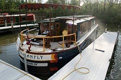
The Grafton Harbor Marina, where we stayed, is one result of the government's shift in flood policy. After the 1993 flood, more than 100 homes and businesses in the town were relocated to higher ground, on the bluff above main street. The marina, on the other hand, was developed as appropriate waterfront development, a floodproof commercial enterprise, on docks that float up, or down, anchored on tall metal posts, fairly impervious to water level.
It's also an enterprise that's thinking about going even greener. The owners told us they're considering installing water turbines along their breakwater, to take advantage of the steady river current to generate electricity. One power plant on the Mississippi River is already doing this. And this week the University of Memphis is exhibiting a novel and promising water turbine . . . designed by a guy with a high school education.
We thought river turbines sounded really cool. And we also thought the metal roofs that shelter some of the marina's slips would be the perfect platform for some nice solar panels!


Hi, Cynthia and Bill--
ReplyDeleteWhen you say, "Government was giving people money, and people would rebuild on the same spot," you mean FEMA was giving away that money. But along came a real, experienced Emergency Manager named James Lee Witt, and he changed all that. He also re-organized FEMA so that it did a better job dealing with floods, hurricanes, tornados, earthquakes, etc., than it had been doing under the Republican administrations of Reagan and Bush I.
BTW, there's a reason why people would re-build their homes on the same spot as their flooded houses: they've had that plot of land in their family for generations, and they were loath to see it gone from their estates even if Uncle Sam gave them wheelbarrows filled with $100 bills. See what happens when you have a relative working for Uncle Sam? You have an insider's view of everything going on in my agency!