On Tuesday we crossed the mouth of the Saint
Lawrence River, in the northeast corner of Lake Ontario, and officially entered
Canada.
The sky was pale blue, feathered with high cirrus
clouds. Our route took us past two large islands, Wolfe Island and
Amherst Island, and we saw more enormous tankers on the horizon.
I’m getting the hang of our nautical GPS
system. It’s like playing a video game in, of course, super slo-mo. You
place the cursor on some intermediate destination—say, the tip of a peninsula
at the end of a bay—and click a button to insert a “waypoint.” On the
screen, you see a tiny boat cruising down what looks like a little roadway
leading to the waypoint. You try to steer the boat so it stays on the
dotted line in the middle of the roadway.
It sounds easy in theory—especially since our usual
cruising speed is about 4 mph. But here’s how you steer: if you
want the nose of the boat to move right, you push the tiller to the left.
If you want to move left, push right. Meanwhile, the little boat on the
screen might be pointing in any direction—right, left, up, or down. So if
you veer off course, your brain cranks overtime figuring out which way to push
the darn tiller.
Also, when you steer, there’s a lag between when
you make your move and when the screen shows your course
correction. So you PUUSSSSH the tiller WAAAAY over, and by the time
the screen shows you to be on course, you are actually WAAAAY off course, in
the other direction.
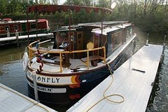
Then there’s the wind, which can push around even our 14-ton vessel. And then there’s the waves. And then
there's the current.
Bottom line: It’s ridiculously easy to
oversteer and end up tracing a crazy zigzag course. That wastes time and fuel.
What IS helpful is the sailor’s old-fashioned
method of “coastal navigation," which is: Find a landmark that
lines up with your desired compass bearing (which the GPS tells you)--say, a
water tower, a conspicuous building, a tree that sticks up above the treeline--and
point the bow at the landmark. Try to hold ‘er steady. That’s it.


