 |
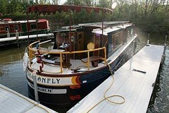
| Our first foray into uncharted--oops I mean charted--waters |
I remember vividly the fourth day of our trip. The chart showed that our route along the Erie Canal would temporarily take us away from the narrow, secure channel . . . out into the waters of Cross Lake. Our first "open water" crossing! Was I nervous? Yes I was.
Of course Cross Lake is a tiny little pond. In retrospect, my terror seems ridiculous. But at the time, I assure you, it was genuine.
As the Erie Canal opened into Cross Lake (which is a good half mile across, but seemed bigger), I scanned anxiously with binoculars across the army-green water. And there they were, right where they were supposed to be--buoys marking the way!
 |
| We also have a set of electronic charts, brand name: Fugawi. Yes, as in the joke: "Where the Fugawi?" |
Navigational charts are like road maps for boats. The item of greatest interest on a chart is the network of tiny green and red dots--navigation buoys.
You figure out which buoys mark the route you want to take, then steer your way from colored marker to colored marker.
Works great (unless there is fog, or high waves, or a buoy has pulled loose from its mooring and drifted out of place, or the sun is in your eyes, or you just dropped your expensive binoculars overboard).
Now, it's been six long months since Cross Lake. We've taking our fearless craft miles offshore--out of sight of land--on Lakes Huron, Ontario, and Michigan. We've negotiated the tricky, granite-strewn channels of Georgian Bay. We feel like we've (mostly) mastered the more arcane details of "aids to navigation," including the following:
- Keep red buoys on your right . . . except for the times when you need to keep GREEN buoys on your right.
- If you can't see the color, look for the shape: Red buoys are pointed; green buoys are FLAT . . . unless a pelican is perching there, in which case green buoys LOOK pointed.
- Where two systems of buoys overlap (as they do here on the Gulf Intracoastal Waterway), treat a red buoy marked with a yellow square like a green buoy. Treat a green buoy marked with a yellow triangle like a red buoy. (Note that the yellow squares and triangles are the size of the proverbial postage stamp, unless they are plastered over with pelican poop and completely invisible).
See! Coastal navigation is easy!
 |
| It's five miles to Port St. Joe, we've got diesel but no photons, it's dark out, it's not raining, and we're not wearing sunglasses. Hit it! |
Yesterday we added a new skill: Night navigation. We wanted to get ahead of some predicted bad weather, so we set out from Panama City for the 40-mile run to Port St. Joe. The wind and the tides were against us, and by the time we left the canal-like confines of the GIWW to enter the wide-open waters in the harbor, it was night. I mean, pitch black night.
 Happily, some of those buoys have lights on them (often powered by little solar panels!)
And the lights blink in distinctive ways. If you can distinguish between the buoy with the red light that is blinking once every two seconds and the buoy with the red light that is blinking once every 4.5 seconds and the red light on the radio tower that is blinking once a second and the tail light of the car traveling along shore BEHIND the buoys that appears to be blinking randomly, you can aim at the proper buoy and grope your way to safety.
(Or here's another option: You can keep your gaze fixed on your GPS, which magically knows the way.)


I like the photos you have been posting but if I was asked to pick my favorite, it would probably be this photo of the approaching sunset. It's an excellent photo and makes me feel as though I'm on deck.
ReplyDeleteThanks, Randy! It was quite a moment--simultaneously gorgeous in the way that kind of swells your heart and and scary in a way that numbs your heart ("Here we go, into the darkness . . .)
ReplyDelete